Monday, May 16, 2011

Peru 2010: Rio Patchachaca

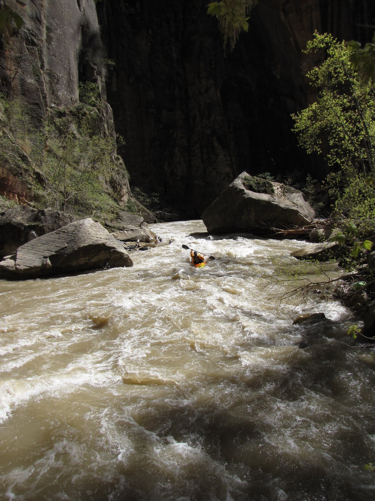
Evan Ross emerging from the shadows, Day 1. Photo: Nate Klema

After getting off the Rio Apurimac, we (Matt Wilson, Ryan Casey, Evan Ross, Ben Luck and Nate and Matthew Klema) stopped in the town of Abancay on the way back to Cuzco. The Patchachaca is a tributary of the Apurimac. This small river flows into the Apurimac about a mile upstream of Puente Pasaje, the take out for the Abysmo section of that river. It wasn’t until 2004 that the Patchachaca was run by Henry Munter and Brian Fletcher. It is surprising that it took so long to get run since it is on the major highway from Lima to Cuzco. It was also the cleanest river I had seen in Peru up to that point. From the road it looks like a low volume kayakers dream.


Nate Klema in the middle of the best sections of the run, late Day 1. Photo: Matthew Klema

We spent a day resupplying and resting up for what would be Matt, Evan and my last trip. Putting on the next morning we realized how quickly this little river was moving compared to the big water we had just gotten off of in the abysmo section of the Apurimac. It was fun to be back on more of what felt like a mountain stream and we headed downstream going through the first bedrock gorge visible from the road and past a lot of hot springs coming out of the walls.


Curtain of hot springs. Photo: Nate Klema

After the first bedrock gorge the gradient eased. The torrent ducks on this river were absolutely amazing. They must have liked this river because of its clarity. They are amazing swimmers. Swimming sieves, up to class VI underwater, and would often drop from the air into the seam of holes, where the downstream and upstream currents meet. By late afternoon the gradient picked up again and we got to some short really rocky steep sections that were only sometimes run able. After some portaging we reached a beautiful boulder garden rapid that was half a mile long. After scouting the whole thing we ran it in two groups of three. When we reached the bottom there was a great area for a camp. Nate and Ben unloaded their boats and headed back upstream to run the drop again.


Rio Patchachaca Canyon, Day 1. Photo: Matthew Klema

After an hour and a half of read and run class IV the next morning and the river’s gorge started to steepen. Picking our way carefully down we rounded a corner and the river dropped off the face of the earth, tumbling through some large holes and minor sieves and then into a major sieve (which the ducks ran). This necessitated an interesting portage with a lot of boat passing and eventual fifteen-foot seal launch back into the river.


Early Day 2, the crux of the run. Most of the river went under the boulders where the picture is taken from.

Photo: Matthew Klema

The rest of the day the river continued a relentless gradient through boulder gardens of granite and limestone. It was very continuous and very good, but in strange places there were very tight drops with very sticky holes backed up by random rocks and strangely placed dangerous sieves. This went on relentlessly for the rest of the day with hardly a pool in sight. I think we each had at least one good hole ride, a large boof onto a rock and each saw a sieve closer then we wanted to. Because of this I would say that this was probably the most serious run that we did while in Peru. I think we were all grateful when it started to get dark and we were able to pull over.

Matthew Klema working downstream. Photo: Nate Klema

The next morning, while the rapids maintained some of the same character, but the pools became more distinct in between them. After an hour on the river we got to a narrow gorge in the limestone bedrock. The whole river went through a little slot canyon about three feet wide for a quarter of a mile, dropping over a few falls directly into inescapable potholes. Then the gradient decreased, we encountered a few short run-able slots though other bands of limestone.

Ryan Casey powering over a large hole. Photo: Nate Klema


Looking back upstream at the confluence of the Apurimac (L) and the Patchachaca (R).

Photo: Matthew Klema

By nine o’clock on day three we reached the confluence with the Apurimac and were in sight of Puente Pasaje just in time to see the bus head up the switchbacks away from the river. We got to spend the whole day with a school group who were down for the day at the river. We had dinner that night in the towns little “restaurant” with the military operations team that had set up a drug checkpoint and do reconnoitering of the surrounding area.

Ben Luck contemplating how he feels about being at the infamous Puente Pasaje for the second time in less then a week. Photo: Matthew Klema

Catching the bus to Andhuyalas the next morning to retrace our steps back to Abancay and then Cuzco. It was a holiday, the Peruvian Halloween essentially, and when we arrived in Abancay that night there was not a place for us to stay, so the friendly Peruvian who we had stayed with four days earlier let the six of us crash on his living room floor for the night since he was out of rooms for the night. Upon getting back to Cuzco the next day. The group planned to go their separate ways. Nate, Ben and Ryan continuing to paddle in Peru. Matt, Evan and I returning to the U.S. to our prior commitments.

A big thanks to Juanito, Daniel, Leo and Diego for everything that they helped us with in Cuzco, from a place to stay to logistical help among many other things, but most of all sharing the rivers of Peru and the common love of Kayaking with us.

Matthew and Nathan Klema


Saturday, May 14, 2011

Kayaking the Zion Narrows with the Arrogantly Challenged

By Kyle McCutchen

Did we sandbag it? That was the question that needed an answer, and was more than a good enough excuse to return to the North Fork Virgin River’s Zion Narrows. The “arrogant sandbagger” guidebook author call-out was a few seasons in the past, but the issue has been far from dead, thanks to a misguided Zion National Park 600cfs flow restriction rule that was enacted because a paddler felt misguided by yours truly, co-author of Whitewater of the Southern Rockies.

We didn’t need to ask if we were arrogant. We knew we were arrogant because we were kayakers, because we believe that passing through committing inescapable canyons can be really easy, and because at 7am here we are standing at the ZNP backcountry permit desk expecting to get a permit despite the flow being 650cfs, because we came prepared and are us.

“Have you run it before?” the desk ranger asks.

“Yes,” I answer with a reinforcing nod and a sleep-deprived evil-eye look that threatens to call the manager. He asks my name and I give it with a slight hesitation, concerned that after the debacles a few years ago I’ll be blacklisted. He checks the flow, has us sign a few things stating the flow isn’t what it is, and let’s us off on our way. We leave quickly, in case his manager shows up, and in awe that we have a permit to kayak the Zion Narrows at a prime level. Our biggest hurdle, negotiating the permit regulations that limit boaters to a narrow flow window, has been accomplished and we are off to explore 15 miles of arguably the most spectacular river corridor in all of Utah.

Our second challenge is to navigate the put-in road that the backcountry ranger warns us might not be open, and we are pleased to find it snow free as we arrive at the put-in to a cold wind and nice flow. We make a plan with Lori Merritt, our team shuttle driver, to promise not to report us missing even if we show up missing, and Justin Merritt, Tina Swan and I launch by 9:30 on a flow that allows us to take paddle strokes immediately from the put-in. The healthy flow is nearly double of what I previously remember, and I am cautiously relieved that we might not have to spend too much time dragging our boats down the streambed.

Tina Swan smiles when she sees waterfalls. Photo: Kyle McCutchen

Sometime after a portage around a cable, a herd of elk, nice side canyon, and scenic waterfall, Tina announces that she has a broken kayak. It’s not good to be barely 4 miles into a run and have to perform a major boat repair patch. We were thankful that we came prepared, and that the walls were starting to close in.


One of the first narrows. Photo: Kyle McCutchen


Tina entering a narrows. Photo: Justin Merritt

Then from roughly mile 4 to mile 5.5 the pace slowed as a few wood portages forced us out of our boats. Making matters worse was our patch job had already torn along the roughly 8-inch crack, and Tina constantly had to drain her kayak. We refrained from using our second boat patch until we had made it to the confluence where there would be less contact with the rocks. At the park service boundary a collapsed bank created a new sieve. It wasn’t the first sign of how much water ran through this side canyon back in December of 2010. In fact, nearly all of the wood portages that I remembered were gone, replaced by new pieces of wood in some inopportune places. The added flow was a blessing though, and with the additional flow the pace had quickened to IV- wood dodging and sight seeing.


Kyle McCutchen is pretty sure that every kayak run should have an easily portageable and totally huckable waterfall like this. Photo: Justin Merritt


Justin Merritt is all smiles after the falls. Photo: Kyle McCutchen

BC Falls had an amazing flow. Enough to boof at the lip, and enough to create a big hole backed up by a boil on the right side of the landing and a seam on the left. Justin and I both had good lines, landing flat on the boil and paddling away. Immediately below this was a two-foot drop where Justin claimed he hit a three-foot boof, followed by a narrow slot with a small hole, one of the few legit rapids up until this point. Could this be the 6-foot falls that we didn’t warn people about? More questions still. A quick push later and we make the confluence.


Just before the confluence with deep creek. Photo: Kyle McCutchen

The confluence with Deep Creek is extraordinary. Leaving the upper slot canyon of the North Fork Virgin River, you enter a much larger canyon, and the flow triples as you peel out into the waters of Deep Creek. Although I think the shuttle would be heinously longer, getting to this confluence in the canyon appears like it might be easier from Deep Creek, especially at lower flows. The piles of discarded trees from the floods were impressive at Camp 2. Less than 10 minutes later we arrived at Camp 3, at 3:40 in the afternoon, with 8 miles to go.

Did we bring enough boat repair supplies? How did we get so far behind schedule even with a great flow? I mean other than Tina draining her boat every 1/3 of a mile. We must be taking too many photos. Wow, this flow is fantastic! And maybe the upper is a little harder than class III… damn sandbaggers. By 4:30 we have Tina’s boat repatched, with her winter hat serving as a makeshift wedge to keep the patch job from breaking. We all agree that Tina isn’t allowed to hit any more rocks, which for the first time all day is now possible thanks to a flow of about 675cfs!


Kolob Creek Rapid Photo: Justin Merritt

Okay, so maybe over 600cfs Kolob Creek rapid becomes a IV-, but it’s still a class III at 450cfs. Actual whitewater noted and appreciated, and we are no longer worried about how much daylight we have left because the flow is fast! Must be time for more side hikes and pictures of the best parts of the Narrows.


Part of the Big Spring waterfalls. Photo: Kyle McCutchen


Big Spring Rapid. Photo: Justin Merritt

The Big Spring Rapid wood situation has created a class IV- slalom move, although if the log on the left side moves (or if you don’t mind rolling under it), then it’s probably still class III+. Although I’ve never received an answer that wasn’t easily contradicted and subjective to the question, “What is the difference between a class III+ and IV-?”


Beginning of the Wall Street section of the hike. Photo: Justin Merritt


I heart Wall Street when flooded. Photo: Kyle McCutchen

I try to not base my whitewater ratings on wood (because that relates to consequence more than navigability), but the speed of the water and the comfort of a paddler to read-and-run a walled in corridor might be getting up to class IV- at levels over 600. We spent the remainder of the afternoon gawking at the walls, and leap-frogging each other to get some photos of the inner parts of the Narrows. We took a short hike up Orderville Canyon, before we put the cameras away for the last time.


Somewhere in lower Wall Street. Photo: Kyle McCutchen


Orderville Canyon boat ramp. Photo: Justin Merritt

Shortly below the end of the developed hiking trail, in the last mile of our run, the largest rapid of the run gave us one last class IV whitewater fix, and we reached the Temple of Sinawava takeout by 7pm.


The riverside Pah Tempe. Photo: Kyle McCutchen

Many great paddling days have ended at a hot springs, as they should. The private Pah Tempe hot springs near the takeout of the NF Virgin Timpoweap Canyon was ours for the late evening and morning hours for $120 for four people (rates vary based on # of people), and $30 for camping.

While relaxing here we debated, and eventually determined that Evan and I did sandbag it, just not at the flow level that some folks say we sandbagged it at. I feel that our description is very accurate in describing the commitment and consequences of having a bad day, and accurately warns that there may be changing wood issues, which there have been. We didn’t foresee a new sieve forming, but these things happen and the overall rating of the run usually doesn’t change, it just gets one mandatory portage. So, for the WWSR edits to the Zion Narrows beta box, the ratings should read something like this:

  • Min 350 III- (IV, P)
  • Low 450 III (IV, P)
  • Med 600 IV- (V-, P)
  • High 1000 V (V, P)

The Zion Narrows has some serious shuttle bunny bait, which is a good thing because it’s a long enough day that it’s nice to not have to drive back to the put-in. Zion National Park is a cool place to explore, there are a few decent eateries, and there are hot springs! Plus the scenic drive back via Hwy 12 rewards the travel weary with some spectacular desert sight seeing. Huge thanks to Lori Merritt for making our weekend adventure that much smoother.


Lori and Justin Merritt. Photo: Kyle McCutchen

The Zion Narrows section of the NF Virgin River is an amazing place to kayak. Please treat the park personnel with respect and hopefully together we can help the park implement a management plan that minimizes the need for rescues, and is less detrimental to the completion of successful descents. Please treat the run with respect and go prepared. The water is cold, the day is long enough to require a constant downstream pace (6+ hours), the portages are short and complicated, and boats break because even at prime flows it’s still shallow. Most of all, it is walled-in and magical.


Photo: Justin Merritt


Wednesday, May 11, 2011

Reno River Festival


This was my first time to the Reno River Festival and it was a great way to kick off the season. The park offers three distinctly different, but all great, playspots. The competition was held in the third feature of the North channel. Water was high due to the warm weather (summer is finally here for me!) so it was a wave hole. Despite being flushy, it did allow big tricks such as blunt to mcnasties and phoenix monkeys. Unfortunately it was my first few days boating this year, and I wasn't quick enough to pull these through consistently.


The feature was considered unattainable, so each competitor had 4 rides, best 2 count during prelims. I scored an okay first ride and a great second ride. With 2 decent rides I tried to step it up, but flushed and received 0 points on my last 2 rides. After watching the rest of the competition I thought I would be on the bubble. My combined score wasn’t the best, but many great paddlers struggled as well.


After the last heat of men, they announced who would move onto the semifinals. I had just made the cut sitting in 10th place and had 2 more rides, best counts, to try to advance to the top 5 for finals. I flushed early on my first ride and hit a loop and spacegodzillas before flushing on a phoenix during my second ride. That was enough to move up to 7th, but not enough to make finals.


The finals was a great show to watch. In the women’s class, Emily and Ruth battled it out switching leads a few times. In the end, Ruth ended up on top. Congratulation to Erin Clancey (3), Haley Mills (4), and Devon Barker (5) with solid performances as well.

The mens class was also highly contested as EJ scored in the 1400s. Stephen then stepped up with 1530 which would be enough to win. Congratulations to Dustin Urban (3), Clay Wright (4), and Craig Kleckner (5) as well.


When I wasn't practicing in Number 3, I played downstream in Number 5 and in the South channel playspot. Number 5 was a powerful hole that gave huge loops! The South channel spot was a small slow paced hole where it was possible to do nearly everything.


Aside from the freestyle the event had a lot to offer. There was slalom, boatercross, SUP races, the Run Amuck running race, and free music throughout the event. If you have been the Reno River Festival, you should check it out next year!


Wednesday, May 04, 2011

Vallecito in The Bone Zone

Guage: 1.85-1.75
Weather Forecast: Crap
Kayaking Motivation Meter: Full

Gear is packed!

After some last minute spring trip planning late Thursday night and Friday morning we rallied a crew:
  • Mike MurfNasty
  • Ben Jebus Carter
  • Chris Mack
  • Scott Dent
  • Myself
Mack, Ben, Mila, and I meet up Friday afternoon and load up. It's actually happening. We show up late to meet Murphy and Dent at Murph's RV site.

The Next Morning Trying to Stay Warm

Finally we motivate after a Pabst and a breakfast bagel.
Murphy, Mack, and Spivy hiking to the putin

Nerve levels were low and Stoke levels were high.

Dent and I Hiking up

The warm weather was definitely a plus

Gearing Up!

First up, Entrance Falls 18' with a cave on the left side that isn't in play much at low water. Everyone has decent lines, but Dent got pushed right into the over hanging wall making a roll impossible. He swims with no consequences just a few strokes to the eddy.

Mack landing a lofty boof!

Trash Can is boney and has some high piton potential. Pick-up Sticks isn't much, but it's fun to boof. Fourth major rapid is Fuzzy Little Bunny. The creek at this level channelizes into a falls on the right and a falls on the left. The center boof at this level is non-existant. Unknown to us all under the river left falls is a scary 10 foot deep cave.

Me moments before my swim

Dent and Murph line up and come out alright, but when I run it I get pushed into the cave upside down. I swim and no one can see my boat. We all start talking, and we decide that I'm going on a hip belay down behind the curtain into a scary room of doom to see if my boat is there.

Setting anchors and discussing worst case scenario options

Attempt #1 ends with me swimming down the channel still not seeing my boat. We adjusted the angle I was being belayed from and try again. Attempt #2, I see my boat fish it out with my leg and clip into it. I pull my quick release and swim the channel to the eddy. The boat went back into the cave and got caught in the sieve at the opening. We set an 8 to 1 pulley ratio and Dent climbs across the river, but still no luck the boat is stuck. Attempt #3, I climb back down there and man-handle it out of the cave, but the rope clipped to it wraps around my legs. I immediately pull my quick release and jump out of the loop and swim to the eddy with my boat behind me. Luckily no gear was lost and I had my boat back. This is the advantage to having a solid crew that has your back in any situation.


Here I go to one of the scariest places I've been on a river
Cave Sieve!

We're exhausted so we eat some food, get all our gear back together, and head down the river.

Next up Paddle Bitch:

Dent in Paddle Bitch

No Way Out and Finish Line go smooth with some great boofs. The canyon opens up and we're all on Perma-Stoke level.

Paying homage for safe swims

If I have any words of advice to people looking at Vallecito in the bone zone it would be, always bring a solid crew and never take this creek too lightly.

Enjoy this video by Chris Mack:


Wednesday, April 27, 2011

A little 801 Love

For the past few weeks there has been a rare abundance of boating in Utah. The Weber river rose up past flood levels, peaking at about 4800 cfs. For those who don't know - that's a ton of water going through the 'mighty weber'. Between and around the electric cow fences and low bridges, the Weber has a few good runs including some class II - IV. At these high levels especially, a wave on the Weber gets to be really good and we call it Riverdale wave. It's pretty easy to find all you have to do is take the 'Riverdale Rd' off I-15 and find your way East to a little parking lot behind the trailor park. Here are some pictures from my times at the wave, including friends, my parents, and fellow CKS squad members Haley Mills and Mike Tavares,who stopped on their way to Reno:

Me (above), my old man and my mom (below)


Haley Mills and Mike Travares layin' some treats (below)


Local paddler Craig Waddell and Billy Bob Malesky (below)


The next time you'll hear from me, I'll be in Reno, Nevada for the annual River Festival! Wish me luck!